ESA First Images From Forest Spotting Satellite Revealed
 Source: See here
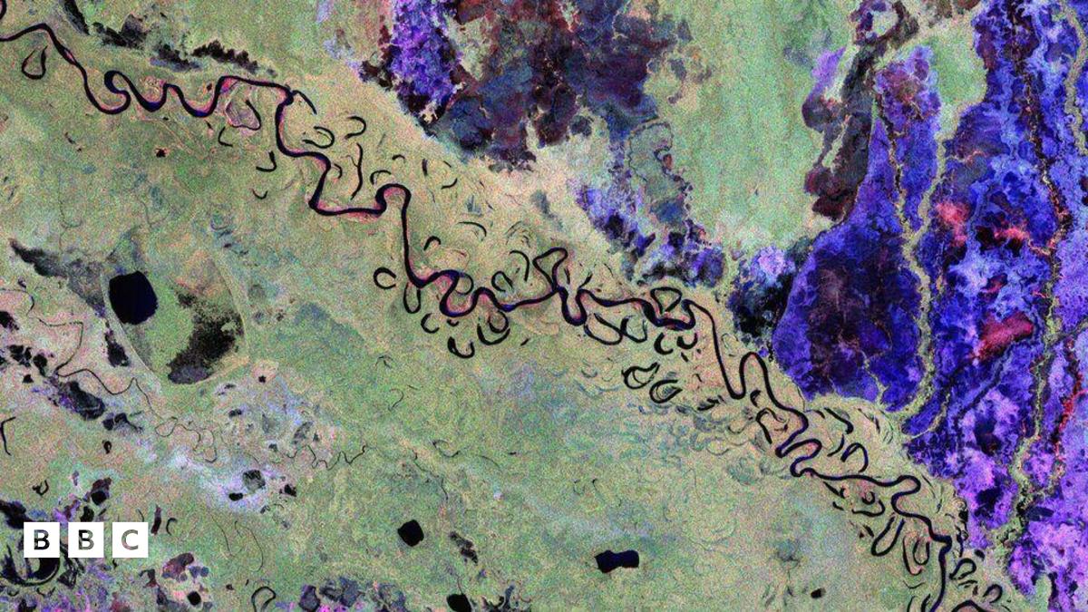
The European Space Agency has revealed the first pictures taken by its new space satellite, Biomass.
The images show in great detail a variety of landscapes from continents across the world including South America, Africa and Asia.
Biomass' five-year mission will provide detailed three dimensional maps of the world's most dense and remote tropical forests.
The Biomass mission was launched two months ago, on 29 April, from Europe's Spaceport in French Guiana.
According to the ESA, these first images released mark a huge step towards understanding how Earth's forests are changing and exactly how they contribute to the global carbon cycle.
This vibrant colours in each picture were created using instruments on board Biomass, with each colour revealing different types of landscape.
For example, green hues mainly represent rainforests, red areas are forested floodplains and wetlands, grasslands are pictured in bluey–purple, while black areas are rivers and lakes.
The team say that, as the mission is in its early days, they are fine-tuning the satellite to make sure it delivers the highest quality data for scientists to accurately determine how much carbon is stored in the world's forests.


Comments
Post a Comment